Greetings!
I thought that this week I'd share with you a short hike I took in an area of Prague entirely unknown to tourists-- my back yard. I live in one of the pre-fabricated, rebar-laden concrete, "rabbit-hutch", communist era, housing estates on the southern edge of Prague. But never fear, I won't be posting photos of my immediate neighborhood. Some other time perhaps?
As it so happens, I live near one side of a beautiful valley-- more of a ravine really. If you know entirely too much about paleontology you might have heard of the Prokop Valley (note regarding the wikilink-- the Prokop Valley does not encompass the stream called "Dalejský potok" that is in a different valley that joins the Prokop Valley. Surprisingly, you can't trust everything you read on Wikipedia). I keep my eyes open for fossils when I hike around there but I never seem to find anything. It's a pretty vast area dominated by limestone cliffs and basalt outcrops. Below the ginger hairball I'll take you up to the top of the cliffs seen in the background of the following photo...

I had a few errands to run on Tuesday. I stopped by my local post office to mail one of my prints off to someone and decided to go for a walk. It's remarkable how quickly I can walk into an area where I can see no buildings.
It was warm enough that what little snow we had on the ground was icy and melting. The light was muted, it was around ten o'clock in the morning and cloudy, but broad patches of blue sky often showed through.
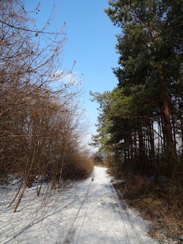
The paths I took up to the top of the cliff were often narrow and wound through the woods. I occasionally stopped to take a photo; sometimes I focused on the broad vistas, sometimes I focused on the little details.

My goal was to visit one of the archaeological treasures of Prague. The site is atop a limestone bluff overlooking the point where the Dalej Valley (and its Dalejský potok) joins the Prokop Valley. The whole area is part of a nature preserve.

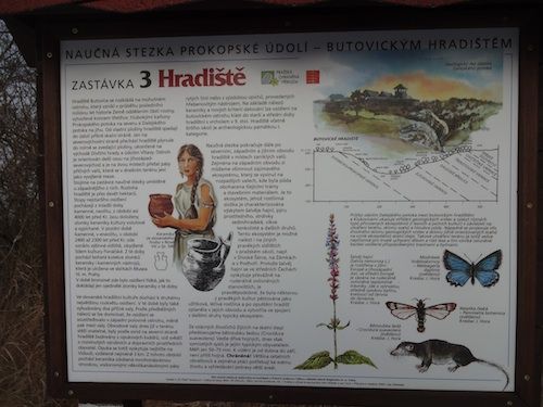
That information panel is one of several found atop the bluff. The aerial photograph of the area seen in the lower right-hand corner shows the (darkly wooded) valley outlined in red as it wraps around the bluff which appears almost like a pointing hand in the center. If you can imagine that pointing hand with perhaps a stubby, darker finger pointing off to the left then you can also see the dark line that would define the wrist and maybe a second dark line where the lightest area ends and a slightly darker patch begins. The slightly darker area is an area of woodland and orchards with a few open grassy areas. both of the lines are what remain of two ramparts built to protect a fortified settlement. There was an extensive archaeological survey of this area in the early 1960s and evidence was found that this area was first settled around 3000 BC. As a fortification, the site of Fort Butovice, ceased to have any strategic importance and fell into disuse around the beginning of the 10th century.
It certainly still commands a grand view of the surrounding area.


The area was peppered with molehills and I examined a few of them hoping that the moles had pushed up something interesting. I found a few shards of pottery and one old piece of bone. Perhaps nothing very old or interesting, but it sure is a beautiful area for hiking.

And here's an informational panel that describes the site and the surrounding flora and fauna in a bit more detail:
Of course this panel says that the oldest signs of habitation here date from the early stone-age around 4000 BC. Then between 2400 and 2300 BC there arose a proper agricultural community but the area became less heavily populated during the bronze age. Then around the beginning of the middle ages the area bloomed again with the ramparts being built of calcite (sort of a fine limestone) the nearest site for this pale stone was over 3 kilometers away. The settlement mostly occupied the western end of the spur behind the western rampart. The remains of that rampart are still visible-- mostly because it's a break in the terrain, about 2 meters (over 6 feet) tall, overgrown with bushes and trees in an area otherwise quite flat and grazed by goats and sheep.
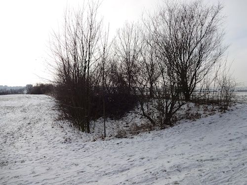
There's not much left of it as you can see from that view taken just outside of it, at the northern end and looking south-southwest along the length.
The outer rampart is in even sadder shape:

That's a view from somewhere about mid-point looking back toward the north. A few lichen covered rocks are visible.
Leaving the area along the road that led past the orchards I stumbled upon an area with a fence topped with shiny, stainless razorwire. Here's the gate:

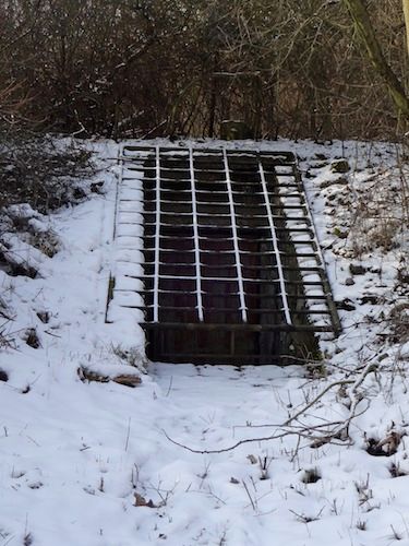
I wondered what was in what looked like the entrance to a cellar or bunker behind the fence.
On the way home the sky cleared: